Maps show flooding in Vermont, across the Northeast
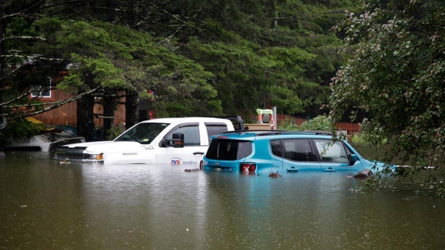
Heavy rain has caused flooding in parts of the Northeast. Some areas, including Vermont and New York state, have declared states of emergency, and one person has died after being swept away by fast-moving water in the wake of extreme weather nationwide.
Weather maps show the areas that are already in flood, as well as what is forecast in the coming days.
The flooding has impacted much of New England. A map by the National Weather Service's Burlington, Vermont outpost showed that in some areas of the state, more than six inches of rain have fallen.
Another map by the NWS records "major flooding" in Vermont and parts of Massachusetts and Pennsylvania, with "minor flooding" observed or forecast in those states and parts of New York.
Here are the latest rainfall reports as we move into the final phase of this long duration storm. In text form: https://t.co/j2TstY10G3Expect updated reports later this morning. pic.twitter.com/L4Ri4734Y3
WaterWatch, a U.S. Geological Survey site that monitors streamflow conditions in the United States and offers hourly updates on weather conditions based on more than 3,000 streamgages, is reporting extremely high amounts of water in the Northeast compared to usual historic measurements.
In some parts of Vermont, New York, New Hampshire, Massachusetts and other nearby states, the WaterWatch streamgages are reporting average water levels that are more than 1,000% higher than usual.
The National Weather Service is forecasting that several gauges in New England will experience flooding in the coming days.
As of July 11, the NWS was forecasting that five gauges would be in "major flood" on July 12. Two would experience moderate flooding, and 11 would see minor flooding, with another two dozen gauges near flooding but not doing so.
The site is not providing forecasts for the area's gauges beyond July 13.
The NWS Northwest office tweeted on Tuesday morning that there is "good news" in the forecast. In the coming days, there is not major precipitation forecast, "giving what's already in the rivers time to move through the system," the service said.
Are we ready for at least a little good news? Here's the precipitation forecast for the next TWO days. While we do have ongoing flooding, we won't be adding to it, giving what's already in the rivers time to move through the system. pic.twitter.com/kwSotxaAPX
The organization said that the water that has fallen will end up in one of two places: Lake Champlain in Vermont or the Connecticut River. The lake is forecast to rise around a foot, and the Connecticut River is "already in flood as far south as Holyoke," Massachusetts.
Kerry Breen is a news editor and reporter for CBS News. Her reporting focuses on current events, breaking news and substance use.
source: https://www.cbsnews.com/news/flooding-maps-vermont-northeast-floods-forecast/